

When it comes to tropical cyclones like Hurricane Sandy, the climate links can be fairly difficult to pin down. On the one hand, humans have warmed the planet about 0.8°C since the Industrial Revolution. As Kevin Trenberth of the National Center for Atmospheric Research likes to say, that affects all weather events to an extent. The oceans are now warmer, there’s more moisture in the air—those things help fuel hurricanes and alter other weather patterns.
And yet trying to attribute specific hurricanes to changes in global temperature remains quite difficult. In its big report on natural disasters last year, the Intergovernmental Panel on Climate Change (IPCC) said it had “low confidence” that humans were currently affecting tropical cyclone patterns. Hurricanes are far more complicated to study than, say, heat waves and the historical record is patchier. (For more on this, Andrew Revkin has an excellent discussion with climatologists over at Dot Earth.)
Looking ahead, meanwhile, scientists can say a bit more about future hurricanes—though only a bit more. The IPCC report noted that it was “likely” that tropical cyclones in some areas would get stronger, with faster winds and heavier rainfall, as the world warmed. The overall number of hurricanes, however, would most likely “either decrease or remain essentially unchanged.”
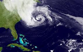
But simply stopping there isn’t quite right either. The chaos caused by Hurricane Sandy does highlight at least one other major reason to worry about climate change: rising sea levels. Note that storm is expected to be so devastating to places such as New York City in part because it’s coming at high tide. Here’s Michael Lemonick:
This nightmare scenario — for New York and the rest of the northeast — is especially likely because Sandy’s storm surge is peaking through three high tides, which magnifies its effect. At the moment, high tide itself is higher than normal because we’re right at the full moon, when tidal effects are at a maximum.
As a result, according to National Weather Service projections and an analysis by Climate Central, it is likely that The Battery in Lower Manhattan, Sandy Hook, N.J., and Atlantic City will see the highest storm tides on record during Monday evening’s high tide. Those records go back to 1893, 1932, and 1911, respectively.
Probability of storm surges greater than six feet around New York City. Source: NOAA
While storm surges are affected by a variety of factors, higher sea levels can help magnify those surges and exacerbate flooding — not just during freakishly large storms like Sandy, but during smaller storms too.
Humans, of course, aren’t responsible for the tides. But we are warming the planet right now, causing glaciers and ice caps to melt and sea levels to rise. In the mid-Atlantic region, the coastal seas have risen about eight inches since 1900–and about a foot in New York Harbor. “That means,” notes Lemonick, “the storm tides from Sandy are that much higher than they would have been if the identical storm had come along back then.”
What’s more, sea-level rise is expected to accelerate in the decades ahead—an additional two to seven feet by 2100, some scientists project. The IPCC concludes that it is “very likely” that extreme coastal flooding during storms will become far more common in the future as a result. And that’s a big problem for cities such as New York, as Mireya Navarro wrote in a prescient piece for the New York Times last month:
Unlike New Orleans, New York City is above sea level. Yet the city is second only to New Orleans in the number of people living less than four feet above high tide — nearly 200,000 New Yorkers …
With higher seas, a common storm could prove as damaging as the rare big storm or hurricane is today, scientists say. Were sea levels to rise four feet by the 2080s, for example, 34 percent of the city’s streets could lie in the flood-risk zone, compared with just 11 percent now, a 2011 study commissioned by the state said.
You can see how a combination of rising sea levels, tides, and storms could affect different parts of the United States with this helpful GIS mapping tool from Climate Central. For New York City, the map shows just a small chance of a major six-foot surge by 2020—it takes a rare storm like Sandy and high tides to pull it off. But as the world warms and sea levels rise, the odds of a big storm surge increase. Suddenly, that freak event won’t be so rare anymore.
The endless debates about whether this or that particular hurricane can be blamed on global warming are fascinating. But they can also distract from the more basic fact that our cities and infrastructure are quite vulnerable to future temperature increases and sea-level rise. And Hurricane Sandy, unfortunately, is a grim reminder of that.